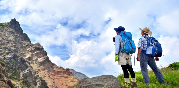
Interested in discovering Japan best hiking trails? Japan is renowned for its traditional culture and cutting-edge cities, but amidst that lies its majestic mountains. For those seeking an escape from the hustle and bustle of urban life, Japan’s hiking trails offer solace, serenity and stunning natural beauty.
Whether you’re a seasoned trekker in search of multi-day excursions or a casual hiker looking for a peaceful day trip, Japan’s diverse terrain has something to offer every enthusiast. From the rugged terrains of national parks to leisurely day hikes just beyond city limits, Japan boasts a vibrant hiking culture catering to all skill levels and preferences. Along the way, you’ll encounter rustic mountain lodges serving hearty local cuisine, providing a warm respite for weary travelers.
In the following sections, we’ll delve deeper into some of Japan best hiking trails, the level of difficulty for each as well as some important things you need to know before hiking in Japan.

Summer trekking (Photo by Katsumi Katagiri/Aflo Images)
Table of Contents
Table of Contents
- Hiking Levels
- Best Times to Hike in Japan
- Ten Must-Visit Hiking Spots
- Five Things to Know Before Hiking in Japan
Hiking levels
Before getting into specific trails, let’s have a look at the difficulty levels associated with each.
Easy
These paths are typically well-traveled and clearly marked, making navigation straightforward. Accessible by public transportation or situated near accommodations, they offer a convenient option for casual day hikes. No specialized equipment is required, making them suitable for hikers of all ages, including families with younger children. For beginners or those seeking a leisurely stroll, easy trails are ideal.
Medium
Medium trails present a moderate challenge, often featuring sections that are steep or lengthy. While manageable for individuals with average fitness levels given ample time, they may require a bit more effort. Hiking boots are recommended for added stability, although not mandatory. These hikes may not be suitable for younger children due to their increased difficulty.
Difficult
For seasoned hikers seeking a more rigorous adventure, difficult trails offer a demanding and rewarding experience. These routes can be long and strenuous, sometimes necessitating maps and navigational skills for successful completion. Proper preparation and equipment are crucial when tackling difficult trails, with hiking boots highly recommended for stability and support. These trails should not be underestimated and require a higher level of physical fitness and endurance.
Best Times to Hike in Japan

Spring Hiking Family (Photo by Katsumi Katagiri/Aflo Images)
Deciding when to take on a hiking adventure in Japan hinges largely on your individual preferences, including availability, desired seasons, and landscape preferences. For avid mountain climbers, midsummer stands out as the prime season, with Hokkaido offering particularly favorable conditions due to its milder temperatures compared to the rest of Japan during this time.
The cherry blossom and fall foliage seasons add a touch of magic to hiking trails. Spring emerges as a popular choice among hikers, as temperatures gradually warm up from the briskness of March to the pleasant conditions of May. Some prefer the fall season, marked by clear, sunny days following the summer rains. The landscapes become adorned with the vibrant colors of Japanese maple and ginkgo leaves which makes for beautiful photographs..
Ultimately, any time of the year presents opportunities for memorable hiking experiences in Japan. Carefully consider your preferences and priorities to determine the most suitable time for your adventure.
Ten Must-Visit Hiking Spots
Daisetsuzan (Hokkaido)
Difficulty: Medium to Difficult
Best time(s): Summer

Earliest Autumn Leaves in Daisetsuzan in Japan (Photo by Hiroyuki Nagaoka/Aflo Images)
Daisetsuzan, the largest national park in Hokkaido, boasts a spectacular volcanic group of peaks. A journey to Daisetsuzan typically spans one full day, encompassing approximately 8 hours of hiking. The pinnacle of this adventure reaches the lofty height of 2,291 meters at Mt. Asahi, the highest point within the park. Hikers can anticipate an elevation gain of 772 meters, traversing a horizontal distance of approximately 18.2 kilometers throughout the course of their trek.
Along with Mt. Asahi, you can also find Mt. Kuro-dake, Mt. Aka-dake, and others. The most popular route ascends via ropeways to the summit of Mt. Asahi. From there, you can traverse the ridge to reach Mt. Kuro-dake, offering relatively easier peaks to conquer. Along the route, you will encounter the Kurodake-ishimuro Refuge, operating from late June to late September, providing essential facilities and goods.
For a convenient descent, a ropeway is available from the seventh station at Mt. Kurodake. Daisetsuzan promises an unforgettable hiking experience amidst its breathtaking natural beauty and diverse landscapes.
Reasons to go: Beautiful mountain peaks, meadows adorned with vibrant alpine flowers, cerulean-hued ponds, steep ravines, and magnificent cascading waterfalls. It is the premier location in Japan to witness the colors of autumn foliage and experience the early onset of snowfall each year. You’ll find numerous onsen hot spring resorts, such as Sounkyo Onsen and Asahidake Onsen.
Getting There: The primary access points to Daisetsuzan are through the Asahidake Ropeway located in the southeast and the Sounkyo Kurodake Ropeway situated in the northwest.
Asahidake Ropeway – It takes approximately 1 hour by car from Asahikawa Airport or via the Ideyu-go bus service, which stops at Asahikawa Station and the airport.
Sounkyo Kurodake Ropeway – it’s about a 1.5-hour drive from Asahikawa Airport or a 2-hour journey by Dohoku Bus from Asahikawa Station. From Kamikawa Station on the JR Sekihoku Main Line, it takes about 30 minutes by bus.
For optimal exploration of Daisetsuzan National Park, renting a car is the most convenient option, as public transportation services in the area are often sparse, time-consuming, or altogether unavailable. Rental car facilities are conveniently accessible at Asahikawa Airport, in central Asahikawa, and at various other airports and major cities throughout Hokkaido.
Mt. Zao (Miyagi and Yamagata)
Difficulty: Medium
Best time(s): Summer and Fall

Mt. Zao, Okama, Horseback, Summer Morning, Miyagi Prefecture, Yamagata Prefecture (Photo by Aflo Images)
Mt. Zao typically takes approximately two hours to hike. Its highest point stands at 1,841 meters atop Mt. Kumano. With an elevation gain of 384 meters and a horizontal distance of 5.4 kilometers, it offers a manageable yet rewarding trekking experience.
The region surrounding Mt. Zao derives its name from the mountain range, renowned for its striking Okama Crater measuring 300 meters in diameter. This unique body of water exhibits varying colors that reflect changes in volcanic activity and water quality. Within this area lies the Zao Fox Village and the Zao Kokeshi Museum, boasting Japan’s largest collection of kokeshi dolls.
This trail has wide rocky paths and with guideposts and fences for your convenience. Nevertheless, during inclement weather, caution must be exercised to avoid getting disoriented due to the thick fog. Additionally, given recent volcanic activity, it is strongly advised for hikers to gather information beforehand to ensure a safe and enjoyable hiking experience.
Reasons to go: Mt. Zao is one of the few places in Japan where silver frost adorns the landscape. Aomori Todomatsu trees adorned with silver frost, known as “snow monsters,” are a sight to behold from January to February.
You can unwind in one of the area’s many hot spring villages, including Aone Onsen and Gaga Onsen, providing a cozy retreat to relax and rejuvenate. Opportunities to savor local delicacies like Shichikashuku soba and premium strawberries from Ichigo World. Mt. Zao offers an ever-changing landscape that captivates visitors throughout the seasons, from the breathtaking cherry blossoms along the riverside in spring to the beautiful autumn foliage along the Zao Echo Line highway.
Getting there: Starting from Yamagata Station, board the Yamako bus heading to Zao Onsen Bus Terminal. Upon arrival at Zao Onsen Bus Terminal, it’s a leisurely 15-minute walk to reach Zao Ropeway’s Zao Sanroku Station. Take the Sanroku Line of Zao Ropeway to reach Juhyo Kogen Station. From there, transfer to the Sancho Line of Zao Ropeway to reach Jizo Sancho Station.
Kamikochi (Nagano)
Difficulty: Easy to Difficult
Best time(s): Spring, Summer, Fall

Azusa River and Kappa Bridge, Kamikochi, Nagano (Photo by TTak/Aflo Images)
Kamikochi, nestled in the serene mountains of Nagano prefecture, is widely acclaimed as the premier hiking destination in the Japanese Alps. Kamikochi boasts some of the most breathtaking mountains in the entire country. Its pristine landscapes, coupled with a well-organized bus system, have made it a bustling hub for hikers, rivaling even Mt. Fuji.
Among the notable peaks in Kamikochi, Yarigatake and Oku-Hotaka reign supreme as the 5th (3,180m) and 3rd (3,191m) highest mountains in Japan. Each demands a duration of three to four days for completion. The Kamikochi-Yarigatake-Hotaka loop trail stands as Japan’s most esteemed hiking trail. It traverses the infamous ridgeline, the Daikiretto. It’s lauded for its scenic beauty and challenging terrain. However, it’s worth noting that the trail can pose risks for those lacking experience in rock climbing.
Mountain lodges (or yama-goya) provide futons, bunk space, and meals. Guests are typically provided with two meals, and occasionally, a simple lunch is included as well. While some lodges don’t require reservations, there are a few that do. The Yarigatake mountain hut provides the convenience of online reservations. However, most huts exclusively accept reservations via phone. If opting for camping in a tent, reservations are typically unnecessary unless during public holidays.
Reasons to go: The romantic ambiance of Taisho Pond, with stunning views of the surrounding mountains and reflections on its surface. The iconic Kappa Bridge, a popular spot for photography, surrounded by shops, restaurants, the visitor center, and numerous trailheads. The walking paths alongside the Azusa River also showcase breathtaking scenery and offer invigorating fresh air.
Getting there: A convenient direct bus service is available from Kyoto, Osaka, and Tokyo, offering hassle-free transportation to the desired destination. Travelers from Kyoto and Osaka can opt for a direct bus to the Shinhotaka Ropeway, providing access to the mountains in Kamikochi as well. Alternatively, visitors can choose to arrive via train to Matsumoto Station or Takayama Station in Gifu prefecture, followed by a bus ride to the desired destination.
Kamakura (Kanagawa)
Difficulty: Easy to Medium
Best time(s): Year-Round

Great Buddha and cherry blossoms in full bloom in Kamakura (Photo by Hiroyuki Nagaoka/Aflo Images)
Kamakura has the ocean to the south and lush wooded hills in all other directions, creating a picturesque setting. Scenic hiking trails wind through these hills, providing access to various temples scattered along the way.
Here you will find the Daibutsu Hiking Trail to the west, the Tenen Hiking Trail to the north, and the Gionyama Hiking Trail to the east. Each trail gives a unique experience and varying levels of difficulty, catering to different preferences.
The Daibutsu Hiking Trail: This extends from Kita-Kamakura Station, passing through Tōkeiji Temple and Jōchiji Temple, before winding through the hills to reach The Great Buddha and Hasedera Temple. This scenic route typically takes approximately 60–90 minutes to traverse. An appealing feature of the western trail is the opportunity to discover Itsuki Garden, an open-air café terrace in the mountains, offering a selection of food and drinks.
Tenen Hiking Trail: Starting at Kenchōji Temple, the Tenen Hiking Trail goes through the northern hills, passing by Shishimai Valley before concluding at Zuisenji Temple. This route also requires around 60–90 minutes to complete. Along the way, you will encounter numerous tombs and will have many opportunities to admire the fall foliage during that season.
Gionyama Hiking Trail: As the shortest of the three trails, the Gionyama Trail can be completed in approximately 30 minutes. Starting near Kamakura Station at Myohonji Temple, this trail leads to Yagumo Shrine and the Harakiri Yagura (cave tombs), offering views of the cityscape. For the best experience, it is recommended to save the eastern trail for last, as it provides the best view of the area at sunset.
Getting there: From Tokyo Station, Shimbashi Station or Shinagawa Station, take the JR Yokosuka Line and get off at Kamakura Station.
You can also get to Kamakura Station via the JR Shonan Shinjuku Line from Shinjuku Station. Only trains heading towards Zushi, which operate approximately every second train, offer direct connections to Kamakura. Otherwise, you will need to transfer trains at Ofuna Station.
Mt. Fuji (Yamanashi and Shizuoka)
Difficulty: Difficult
Best time(s): Summer

Mt. Fuji from Daibosatsu Ridge Yamanashi Pref. (Photo by Aflo Images)
Mt. Fuji, towering at 3,776 meters, holds the distinction of being Japan’s highest mountain peak. This iconic summit has been a UNESCO World Heritage site and a symbol of artistic inspiration and religious pilgrimage for centuries. Mt. Fuji straddles the border between Shizuoka and Yamanashi prefectures.
The designated climbing season for Mt. Fuji spans from early July to early September. Climbing outside of this season is strongly discouraged due to the harsh weather conditions, the presence of snow and ice, and the lack of support facilities.
Mt. Fuji offers four main routes leading to its summit: Yoshida, Subashiri, Gotemba, and Fujinomiya. Each of these routes have ten stations, with the first station situated at the base and the tenth at the summit. Climbers usually opt for starting at the 5th station, which is accessible by road.
Yoshida Trail has an abundance of mountain huts and amenities which make it the most popular route. It has separate paths for ascent and descent. Beginning at an elevation of 2,300 meters at the Fuji-Subaru Line 5th Station, the ascent to the summit typically takes five to seven hours, with the descent taking three to five hours. Widely regarded as the most manageable route, and is highly recommended for novice climbers.
Subashiri Trail is on the east side and sets off from an elevation of 2,000 meters. Expect to take roughly five to eight hours to reach the summit and an additional three to five hours for the descent. Unlike the Yoshida Trail, the Subashiri Trail offers fewer mountain huts, making it a better choice for experienced hikers seeking a quieter route. Passing through intermittent dense forests, this trail provides occasional shelter from the sunlight. Near the eighth station of Mt. Fuji, the Subashiri Trail converges with the Yoshida Trail.
Gotemba Trail is known for its gentle incline and has the fewest climbers. As a result of this, it has the least congestion among the four trails to the peak of Mt. Fuji. The ascent starts at approximately 1,400 meters above sea level at the Gotemba 5th Station. As there are limited facilities along the initial part of the route, it is advisable to ensure you have all necessary supplies with you or purchase them at the 5th station.
Fujinomiya Trail is the closest route to the summit, the Fujinomiya 5th station offers the shortest path to the peak. It begins at an altitude of 2,400 meters, the highest among the four. Nevertheless, it is characterized by steep terrain and does not provide separate trails for ascending and descending.
Climbing Mt. Fuji is a demanding endeavor, requiring physical fitness and careful preparation. The ascent is steep, and the air grows thin at higher elevations, posing challenges to breathing. To ensure a safer and more manageable climb, it is recommended to spread the adventure over two days and spend a night at a mountain hut located at the seventh or eighth station of Mt. Fuji. Additionally, maintaining a calm and steady pace and taking frequent breaks is essential to avoid altitude-related health issues. Some mountain huts even offer canned oxygen for purchase in the event of an emergency.
Reasons to go: Reaching the summit provides an opportunity to behold a majestic panoramic view of the surrounding landscapes, while witnessing the sunrise from the top. This sunrise, known as “Goraiko” or the “honorable arrival of light,” is renowned for its captivating beauty and promises to be an unforgettable experience. Additionally, Mt. Fuji holds the distinction of being one of Japan’s “Three Holy Mountains,” alongside Mt. Tate and Mt. Haku.
Getting there: There are many ways to access Mt. Fuji and these may vary depending on the direction you are coming from and which trail you decide to take on. Check out the Mt.Fuji website for information regarding your trail of choice as well as information on access and private vehicle restrictions.
Kumano Kodo (Wakayama)
Difficulty: Medium to Difficult
Best time(s): Year-round

World Heritage Site Kumano Kodo Daimonzaka (Photo by Aflo Images)
Located in the Kii Peninsula in the southern part of the Kansai region, this network of pilgrimage trails stretches across three prefectures: Wakayama, Nara, and Mie. At the heart of these trails lie the three grand shrines of Kumano, collectively known as Kumano Sanzan (Kumano Hongu Taisha, Kumano Nachi Taisha, and Kumano Hayatama Taisha), which serve as focal points for pilgrims.
For over a millennium, these routes have welcomed a diverse array of pilgrims. Designated as a UNESCO World Heritage site under the “Sacred Sites and Pilgrimage Routes in the Kii Mountain Range” property, the Kumano Kodo holds significant cultural and historical importance.
Nakahechi Route: This one is highly favored by international visitors. It begins from the town of Tanabe on the western coast of the Kii Peninsula and typically spans two to three days to reach the grand shrine at Hongu. It takes an additional two days to reach Nachi Taisha and Hayatama Taisha. The trail is well-marked, and you will encounter numerous villages along the way, offering opportunities for rest, dining, and accommodation.
Kohechi Route: Spanning through challenging mountainous terrain, the Kohechi Route links the sacred sites of Koyasan and the Kumano Sanzan. This demanding journey typically extends over four days and requires excellent physical fitness and meticulous planning, as there are limited opportunities for rest or resupply along the trail.
Iseji Route: This route runs along the eastern coast of the Kii Peninsula and stands as the longest among the trails. While it offers a more moderate difficulty level compared to the Kohechi Route, completing the journey takes approximately a week to complete.
Throughout the routes, you will have a range of accommodation options available, including family-operated bed and breakfasts (minshuku), traditional Japanese inns (ryokan), and modern hotels. Additionally, rest stops, toilet facilities, and vending machines are conveniently located at specific points along the hiking trails.
Reasons to go: Traversing the Kumano Kodo offers an immersive experience in Japan’s natural and cultural heritage. With its picturesque mountain landscapes, verdant forests, cascading waterfalls, meandering rivers, and charming villages, the trail provides a spiritual journey intertwined with the beauty of nature and the richness of Japan’s history.
Getting there: From Shin Osaka Station, board the JR limited express bound for the Kii Peninsula. The train will make several stops along the western side of the peninsula, including Kii-Tanabe Station, Shirahama Station, Kushimoto Station, and Kii-Katsuura Station.
Alternatively, if you’re traveling from Nagoya, hop on the JR Nanki limited express train headed for the eastern side of the Kii Peninsula. This train will stop at Owase Station, Kumano-shi Station, Shingu Station, and Kii-Katsuura Station.
Consider purchasing the Ise Kumano Tourist Pass for convenient train travel to and around Kumano. Priced at ¥16,500 for adults and ¥8,250 for children, this pass is valid for five consecutive days. This pass can be used on all JR conventional rail lines, the Sangu Line, the Kansai Main Line to Osaka, and the Kansai Airport Line. It also includes bus transportation around the Kii Peninsula.
Mt Tsurugi (Tokushima)
Difficulty: Medium to Difficult
Best time(s): Spring, Summer and Fall

Peeing Boy statue with Iya River below, Tokushima Prefecture (Photo by Yoshio Shinkai/Aflo Images)
Located in the Iya Valley, Mt Tsurugi proudly claims the title of the second-highest peak in West Japan. The primary route is a circular trek that incorporates a chairlift and entails minimal changes in altitude. A day hike on this trail spans approximately 3.5 hours. With its highest point reaching 1,955 meters and covering a horizontal distance of 6.6 kilometers, this journey offers an ideal balance of challenge and enjoyment.
Begin your ascent by taking the chairlift from the Minokoshi trailhead up to Nishijima, where you’ll find tea shops and the revered Tsurugi-jinja Shrine. While there are multiple hiking paths available, including routes that traverse the ridgeline from Nishijima in various directions, the main route offers the most level terrain.
For overnight accommodations or a delicious meal, consider stopping at the Tsurugisan-chojo Hutte.
Reasons to go: This mountain is nestled within the Iya Valley which offers unspoiled natural beauty, with narrow river gorges, rustic vine bridges, and rejuvenating hot springs. Don’t miss the chance to experience the area’s unique attractions, including the famous vine bridges, counted among Japan’s Top 3 Unusual Bridges. Additionally, take in the scenic thatched homes in the quaint Ochiai hamlet, offering a glimpse into traditional rural life in Japan.
Getting there: From Okayama station, transfer to the Limited Express Minamikaze, and get off at Awa-Ikeda station. Switch to the JR Tokushima line and head to Sadamitsu station. From Sadamitsu station, take the Mt. Tsurugi Hiking Bus (Tsurugisan Tozan Rinji Bus) to Minokoshi, a journey lasting around 2 hours. It’s important to note that the Mt. Tsurugi Hiking Bus operates solely on Saturdays, Sundays, and holidays from mid-July to mid-November.
Mt. Daisen (Tottori)
Difficulty: Medium
Best time(s): Summer and Fall

Tottori Prefecture Daisen in autumn leaves and starry sky (Photo by Aflo Images)
Mt. Daisen has held sacred significance for centuries, with its trails serving as crucial pilgrimage routes in bygone eras. This trek traces the Natsuyama Trail to Misen Peak (1,709 m), the highest accessible point on Mt. Daisen (1,729 m), passing by Daisenji Temple, a significant Buddhist site dating back to the 7th century.
Daisenji Temple also serves as the starting point for the popular ascent of Mt. Daisen. While the mountain’s summit comprises a ridge featuring several peaks, including the highest point, Kengamine Peak (1,729 m), access to the knife-edge ridge leading to it has been closed since a 2000 earthquake caused trail erosion. As an alternative, you can ascend to the nearby Misen Peak (1,709 m) instead.
The ascent to Misen Peak spans about four kilometers and entails a challenging three-hour climb, primarily consisting of steep stairs. Initially traversing dense beech forests, hikers are greeted with breathtaking vistas of the surrounding terrain halfway up the mountain. In the final stretch, the trail transitions to wooden boardwalks, elevated above the alpine vegetation near the summit.
Reasons to go: Daisen has one of the largest beech forests in Western Japan. During late October and early November, the maple and beech forests adorning the mountain slopes erupt in vibrant hues of autumn foliage, adding to the scenic allure of the trek. At the ninth station, there are rare plants that can only be seen here.
Getting there: The bullet train (Nozomi) from Tokyo to Yonago takes approximately 5 hours and 20 minutes, requiring a transfer in Okayama. From Osaka, the journey to Yonago lasts about 3 hours.
Alternatively, an overnight express train equipped with sleeping berths can get you from Tokyo to Yonago in approximately 11 hours.
For budget-friendly travel, express buses operate daily between Yonago and various major cities. The overnight bus departing from Tokyo typically takes around 10 hours and 30 minutes.
Conveniently, buses run five times daily between Yonago train station and Daisen Temple, as well as between Yonago airport and the train station.
Kirishima (Miyazaki and Kagoshima)
Difficulty: Easy to Medium
Best time(s): Spring, Summer and Fall

Kirishima mountain range in bloom (Photo by Aflo Images)
The Kirishima mountains have some of the best volcanic scenery and hiking opportunities. Mt Karakuni is the highest peak in the park standing at 1,700 meters and offers several trail options for reaching its summit. It has a volcanic crater that is 900 meters in diameter and 300 meters deep. The trail to the peak is relatively easy, making it accessible even for beginner hikers.
Climbing from Ebino Highland to the peak of Mt Karakuni takes just 90 minutes, making it a popular spot to witness the sunrise in the early morning. It is especially popular among tourists during the blooming season of the Kyushu Azalea (rhododendron kiusianum). The views from Mt. Karakuni are truly remarkable; on clear days, you can see the entire Kirishima volcanic range and even catch a glimpse of Sakurajima in the distance.
Due to frequent volcanic eruptions of Shinmoedake, it is frequently off-limits for hiking due to ongoing volcanic activity. As of March 1, 2024, a restricted area has been established around Ebino Kogen due to volcanic activity near Mt Ioyama. Consequently, certain hiking paths around Shinmoedake and Karakunidake, including significant sections of the ridge trail, are currently inaccessible and closed until further notice.
Reasons to go: The Kirishima Mountains have a remarkable array of active volcanic peaks, picturesque crater lakes, and lush natural forests. It also features a lot of natural hot springs and offers a variety of accommodation options, from campgrounds to luxurious onsen hotels. At the summit of Mt Takachiho-no-mine, you will get to enjoy breathtaking views along with the sacred halberd Ama-no-Sakahoko. This holds significance as one of Japan’s three sacred treasures (nihon san-ki).
Getting there: Public transportation to and from the different trailheads is notably sparse and inconvenient. Given this circumstance, it is advisable to opt for a rental car when exploring Kirishima. Rental services are available in Kagoshima, Miyazaki, and at Kagoshima Airport.
Bus services are available with 2-3 buses operating daily between Maruo Onsen, via Ebino Kogen, and the Takachiho-gawara Visitor Center. The one-way journey between Maruo Onsen and the visitor center through Ebino Kogen typically takes one hour.
Yakushima (Kagoshima)
Difficulty: Easy to Difficult
Best time(s): Spring, Summer and Fall

Yakushima, early summer Senpiro Falls, Sempiro Notaki (Photo by Masahi Hayasaka/Aflo Images)
Yakushima is a remote island located 135 kilometers south of Kyushu. It was honored as one of Japan’s inaugural Natural World Heritage Sites in 1993. Despite its reputation as Japan’s rainiest spots, with locals joking about “40 days of rain per month,” the island’s rainfall contributes to its beautiful ambiance. One of Yakushima’s iconic attractions is the Jomon-sugi, a colossal cedar tree deep within the mountains, believed to be over 2,000 years old. Many people choose the Arakawa Trailhead to get there.
Mt Miyanoura is the highest peak on Yakushima and an esteemed member of the Hyakumeizan (100 Famous Mountains). You can tackle Mt. Miyanoura either as a day hike with a car, or opt for a more extensive overnight loop hike using public transportation. Along the route, you may encounter occasional ropes for assistance, as well as sightings of indigenous wildlife like deer and monkeys.
All mountain huts on Yakushima are unmanned and free to use, typically equipped with water access. While basic in amenities, they serve as convenient shelters, especially during inclement weather. Due to their popularity, they can get crowded on weekends and holidays, so it’s advisable to arrive early or consider bringing a tent as a backup.
Among the huts, the Shin-takatsuka hut is particularly favored for overnight hikes to Miyanoura, followed by the Takatsuka hut. The Shin-takatsuka hut stands as the closest lodging to Miyanoura, approximately a 2 hours and 40 minutes trek to the peak.
Reasons to go: During the summer, the warm rain offers a unique opportunity to combine hiking with swimming in the scenic Anbo river, which runs alongside the Jomon Sugi hiking trail. Yakushima is renowned for its rich flora and fauna, but its captivating waterfalls provide yet another breathtaking highlight. Ooko-no-taki, the tallest waterfall on the island and Senpiro-no-taki are highly recommended waterfalls to see there.
Getting there: From Kagoshima Port Minami-futo Wharf, take a two-hour ferry to Yakushima’s main ferry terminal Miyanoura Port. From there, take the shuttle bus to Yakusugi Museum. From the museum, take a 35-minute bus ride to the Arakawa Trailhead.
Five Things to Know Before Hiking in Japan
1. Hikers must complete a Tozantodoke, a hiking registration form, which is mandatory in certain prefectures such as Gifu Prefecture. Failure to submit this form can result in fines of up to 50,000 Japanese Yen. There is no specific format for the registration form, allowing hikers to create their own. The form should include essential details such as name, contact address, gender, age, birthday, hiking plan, and the number of people in the group. Submission of the form can be done by placing it in a designated box typically provided at the trailhead or nearby train/ropeway station.
2. For hiking in high mountains, it is advisable to purchase hiking insurance. The cost of this insurance typically ranges between 250 JPY and 500 JPY per day. Alternatively, you can opt for an annual insurance plan, which usually costs between 2500 JPY and 3000 JPY, providing coverage for the entire year.
3. Watch out for bears (Kuma) and Hornets (Suzume-bachi), especially in Spring and Autumn. The bears found in the Kanto region are of the smaller Asian variety, and while they don’t hibernate, they pose less danger compared to brown bears. However, in Hokkaido, where the larger Ezo bear resides, the threat level is higher. Over the past decades, the populations of bears and wild boars in Honshu have increased significantly, leading to occasional infestations and human casualties. To reduce the risk of encountering a bear, using a bear bell can be effective.
4. The habitat of Japanese mountain leeches, known as Yamabiru, is expanding. At trailheads located within these habitats, you’ll often find signs in Japanese warning hikers to “Watch out for mountain leeches!” Nearby, you may also encounter bags of salt or saltwater to apply to your shoes as a deterrent against leeches. While salt may offer temporary protection for about an hour, it’s important to note that its effectiveness diminishes over time. For more reliable protection, it’s advisable to regularly apply insect repellent to both your shoes and body during your hike.
5. For your safety, refrain from trailing off course. If possibly, try to learn a few essential kanji like the name of your destination, 現在地 (genzaichi, you are here) and 注意 (chui, caution).